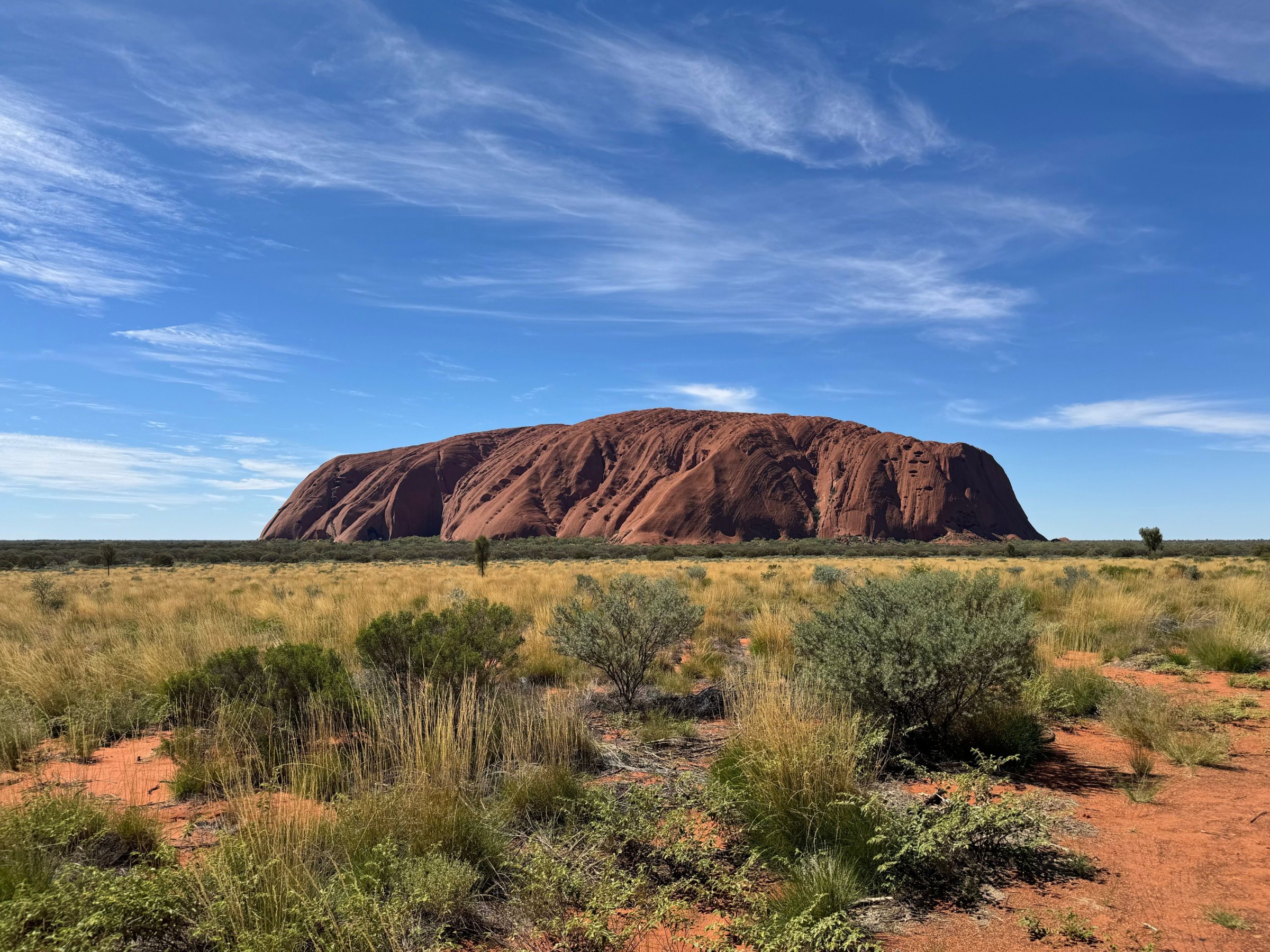
Uluru is not a boulder dropped on the desert but the tip of a tilted slab of sandstone that runs kilometres underground. To Anangu, its Traditional Owners, it is also a living place of law and story. Here is how the rock formed, and how to visit it well.
How did Uluru and Kata Tjuta form?
The story starts about 550 million years ago, when the Petermann Ranges to the southwest stood far taller than today and rain washed huge fans of sand and gravel off their slopes. Around 500 million years ago a sea covered the area and buried those fans under sand and mud, pressing them into rock: arkose sandstone at Uluru and a conglomerate of granite and basalt boulders at Kata Tjuta.
About 400 million years ago the sea drained away and the earth's crust buckled. Kata Tjuta tilted only slightly, but Uluru was tipped onto its side by about 90 degrees, which is why its rock layers run almost vertically. Over the last 300 million years the softer rock around them wore away, and both formations continue underground for up to 6 kilometres.
What are the main sights of the Red Centre?
- Uluru348 m high · 9.4 km around the base A single slab of sandstone that glows red at sunrise and sunset.
- Kata Tjuta36 domes · up to 546 m high Its Pitjantjatjara name means "many heads"; it lies 50 km by road from Uluru.
- Kings CanyonWalls about 100 m high · 6 km Rim Walk A sandstone gorge in Watarrka National Park.
- Alice Springs465 km by road from Uluru The Red Centre's town, at the foot of the MacDonnell Ranges, about 5.5 hours' drive away.
- Larapinta TrailOver 230 km · 12 sections From the Alice Springs Telegraph Station to the top of Mt Sonder.
Uluru and Kata Tjuta together form Uluru-Kata Tjuta National Park, World Heritage-listed in 1987 for its natural values and again in 1994 as a cultural landscape, one of only four dual-listed sites in Australia. Kings Canyon, in Watarrka National Park, is a long day trip away along the Lasseter Highway and Luritja Road. Alice Springs sits 465 kilometres northeast, and the Larapinta Trail runs west from town along the spine of the West MacDonnell Ranges.
Who are Anangu, and what is Tjukurpa?
Anangu are the Aboriginal Traditional Owners of this country, and archaeological evidence shows Aboriginal people have lived in Central Australia for more than 30,000 years. Their law and culture rest on Tjukurpa: the stories of the Ancestral Beings who created the world, which also teach how to find water and food, how to behave and how to travel the land. Tjukurpa is not written down. It is passed on through ceremony, song, dance and art, and some of it is secret and sacred.
Why did the Uluru climb close?
For decades the climb was sold as a highlight, even though climbing Uluru is not generally permitted under Tjukurpa. The park was handed back to Anangu on 26 October 1985, and from the 1990s signs at the base asked visitors, on Anangu's behalf, not to climb. In November 2017 the park's Board of Management voted unanimously to close it, and the climb shut for good on 26 October 2019, 34 years to the day after Handback.
The park is jointly run by Anangu and Parks Australia. Former board chair Sammy Wilson called the closure "a cause for celebration".
How do you visit Uluru and Kata Tjuta?
Most visitors fly into Ayers Rock Airport near Yulara, about three hours from Sydney, or drive 465 kilometres from Alice Springs. A pass for Uluru-Kata Tjuta National Park costs $38 per adult for three days (under-18s free) and is best bought online. Walk the 10.6-kilometre Uluru base walk (about 3.5 hours), join a ranger-guided Mala walk, and loop the 7.4-kilometre Valley of the Winds at Kata Tjuta. Stay on marked tracks, and never photograph signed sensitive sites.
Give it at least two full days: sunrise and sunset at the viewing areas, the Cultural Centre near the rock, and Kings Canyon if you can. Drones are banned in the park, and using park photos commercially needs a media permit.
How hot is it, and when should you go?
Summer in the Red Centre is fierce. Daytime temperatures often climb well above 35°C and can reach 47°C, while winter nights can drop to −7°C with frost on the ground. Anangu recognise five seasons rather than four, from wari, the cold time of late May to July, to kuli, the hottest stretch at the end of the year, when storm clouds bring lightning but little rain.
Heat is the real danger here. Carry and drink at least one litre of water per person per hour, start early, and avoid walking between 2.30 pm and 6.30 pm; in summer the park strongly advises not walking after 11 am. When 36°C or more is forecast, the Valley of the Winds closes beyond Karu Lookout from 11 am, and from September to April the Kings Canyon Rim Walk must be started before 9 am.
So when should you go? The cooler months from about May to September are the easiest for walking, with clear days and cold nights, and from August the warm piriyakutu season brings flowering plants. Whenever you come, remember that this is Anangu land, where Tjukurpa is still lived, and treat it with the respect you would give any place of worship.
For where to stay and what else to see, read the Northern Territory guide and, for the coast, our Ningaloo snorkelling and diving guide.
Facts checked October 2026. Rules, fees and conditions change, so check with the operator, park or lifeguard before you go.
- Parks Australia: Uluru-Kata Tjuta geology
- Parks Australia: Uluru climb closure
- Parks Australia: park passes, walks, staying safe and photography (uluru.gov.au)
- NT Government: Watarrka National Park and Larapinta Trail (nt.gov.au)